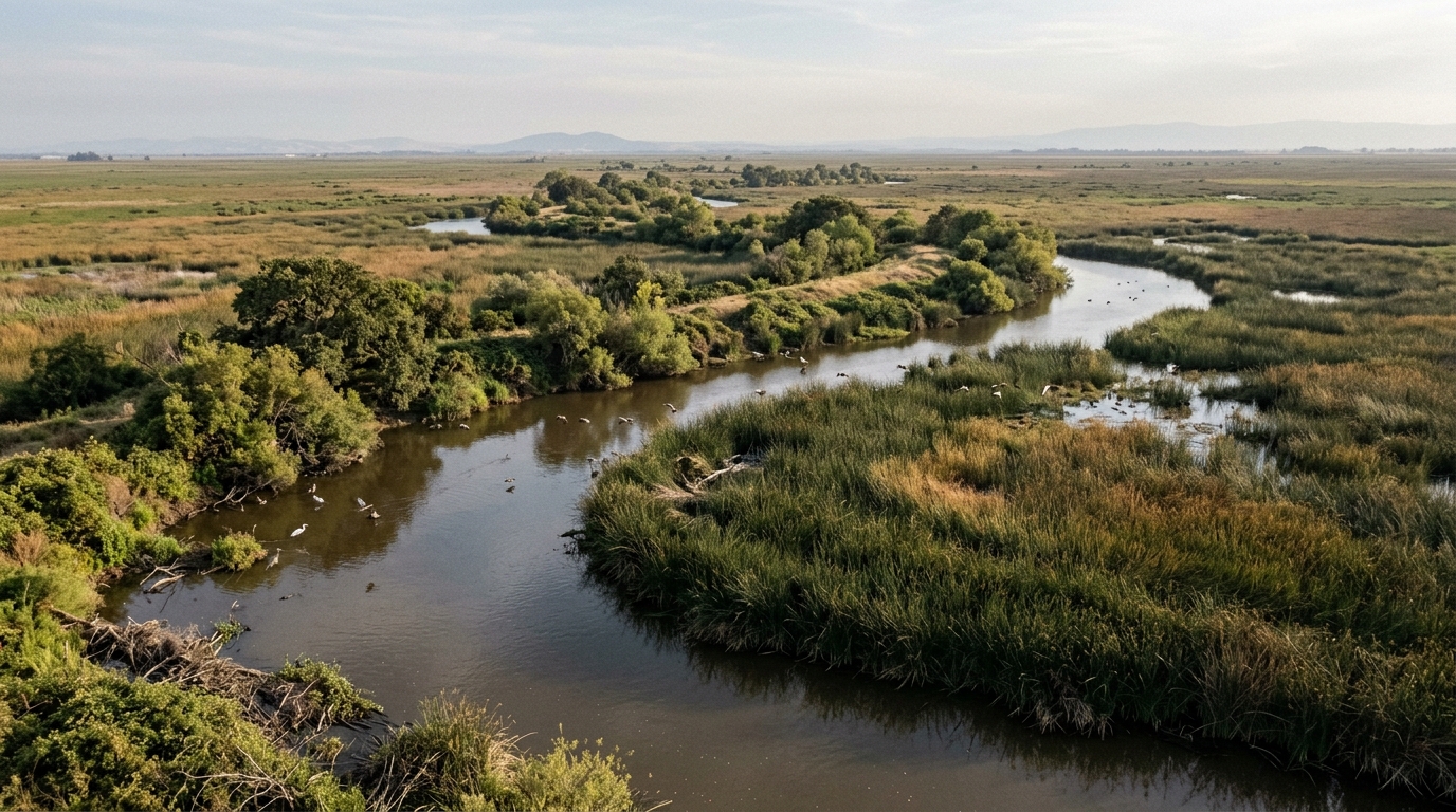
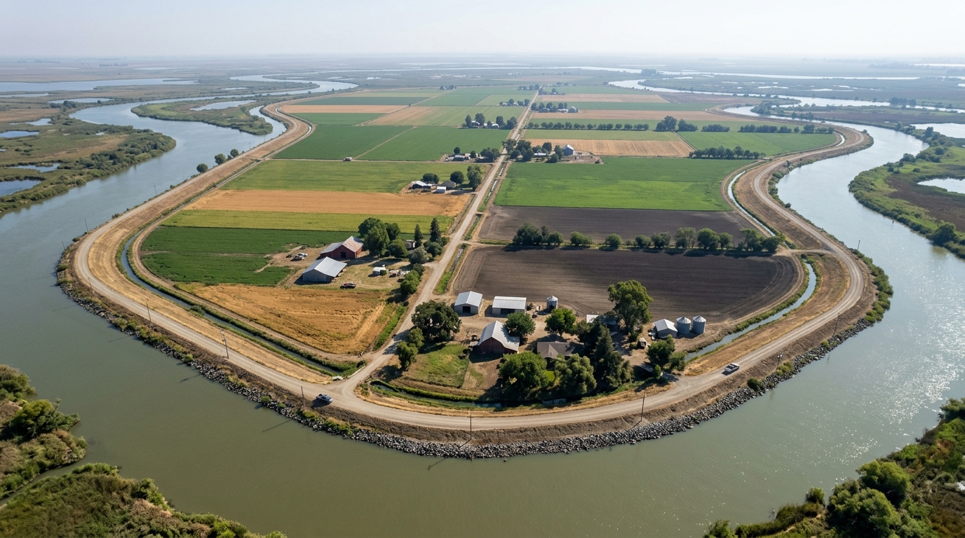
The San Joaquin Delta can look like a patchwork of fields, rivers, and country roads. Much of this landscape was engineered. In the nineteenth century, levees and drainage works turned tidal wetlands into farm islands. That change created productive land and new communities, while altering waterways, soils, and lives already connected to the region.
For Stockton, this is more than a farming story. The city sits beside a working river landscape where Indigenous knowledge, immigrant labor, agricultural commerce, and modern water systems meet. Levee history helps explain why the Delta remains both a local concern and a statewide issue.
Before levees, water shaped life
Before levee roads and farms, the Delta was a shifting estuary of tule marshes, natural levees, sloughs, and seasonal waters. It was not empty land. Native communities lived with this environment and used its waterways and resources for food, travel, and cultural life.
The Port of Stockton’s pre-1850s account identifies Rough and Ready Island as traditional Yokuts territory. It notes that Plains Miwok and Wintun peoples may also have used or settled there. The page describes knowledge of navigation, canoe-making, fishing, basketry, storytelling, and healing, as well as violence and loss after Euro-American contact. This matters because “reclamation” can make the land sound unused before farms. It was not.
For Native communities, waterways were routes, food sources, and parts of a living homeland. The Port of Stockton’s history of the pre-1850s Delta offers a local starting point. A fuller account should recognize displacement and colonial violence while noting that Native communities and their ties to the Delta continued.
Drainage remade the Delta into farm islands
In the nineteenth century, laws encouraged states to drain and cultivate wetlands. The federal Swamp Land Act of 1850 enabled transfer of swamp and overflowed lands to states that agreed to make them productive. In the Delta, settlers and landowners built levees, dug drainage canals, pumped water, and cleared marsh vegetation for farming.
A levee is an embankment that holds water back. Networks enclosed low-lying tracts, while canals and pumps moved water off the land. Many tracts became islands separated by rivers and sloughs. The final Sacramento-San Joaquin Delta National Heritage Area Management Plan describes the change from tule marsh to a system of levees, farms, and waterways.
Chinese labor and changing technology
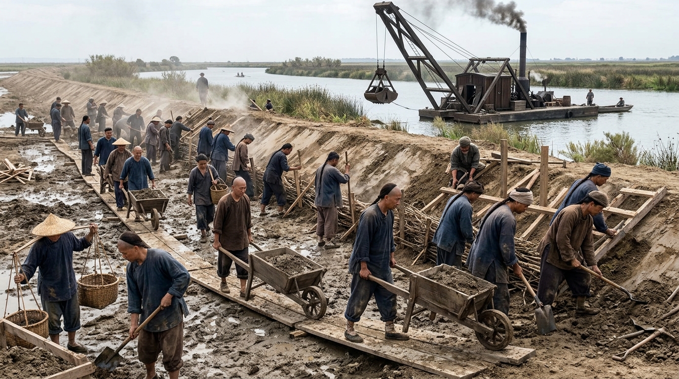
The transformation depended on human labor as well as machinery. The management plan documents large numbers of Chinese immigrant laborers working on levees, drainage canals, and flood-control projects. Their work helped create farmland infrastructure, yet laborers are often less visible in popular stories than landowners, farmers, or engineers.
In 1882, steam-powered clamshell dredges changed levee construction. They cut deeper into riverbeds and moved large quantities of material, enabling higher and stronger banks. By the 1930s, the Delta had become a landscape of farm islands, waterways, and settlements rather than the wetland system that came before.
Stockton grew within a working river landscape
Stockton connected the Delta to wider trade routes. River towns served farmers and settlers, and waterways carried freight between local communities and distant markets. The National Park Service describes the late nineteenth-century reclamation as one of the largest projects of its kind in the United States. It also notes that immigrants from China, Europe, Latin America, Japan, and the Philippines shaped the region through farming, fishing, rail work, and other labor.
This context complements the existing Stockton History article about the city’s Gold Rush-era supply and transportation role. That post focuses on early commercial growth. The levee story adds the landscape around Stockton, showing how wetlands became farms as shipping networks and communities grew.
By the middle of the twentieth century, state and federal water projects added another layer. The Delta became part of systems moving water through California for farms and cities. Its waterways serve local work and recreation, while supporting agriculture, water supply, and habitat. The National Park Service overview of the Delta National Heritage Area describes this mix of rural, agricultural, multicultural, technological, and recreational heritage.
The cost of holding drained peatland
Drainage changed more than the Delta’s appearance. Its wetlands contained waterlogged peat. Once exposed to air, the organic soil decomposed and lost volume. The U.S. Geological Survey says this process caused parts of the Delta to sink below sea level by 9 to 26 feet or more. It reports that about 1,100 miles of levees now protect agricultural islands.
Those figures describe a continuing responsibility as well as an engineering achievement. As land sinks, levees face added stress and need maintenance or strengthening. If a levee fails or water overtops it, an island can flood. The USGS explanation of Delta subsidence connects drainage, peat loss, and levee pressure.
This is not a simple success-or-failure story. Farming supports livelihoods and communities, while water, habitat, and levee systems affect one another. Decisions about one island or project can influence neighboring farms, water management, and the wider estuary. History helps readers see these relationships instead of treating agriculture, nature, and water supply as unrelated.
The Delta remains a living heritage landscape
The Delta is still changing, and debate continues over what to preserve and how to use the land. The Sacramento-San Joaquin Delta National Heritage Area was designated in 2019. Its management plan was approved by the U.S. Department of the Interior in January 2025 and adopted by the Delta Protection Commission in March 2025. It treats preservation, cultural history, natural resources, agriculture, and community life as connected heritage. The Delta National Heritage Area overview summarizes that work.
In September 2026, the Delta Protection Commission opened public comment on a draft farmland-conversion report. The draft estimates that agriculture covers about 416,700 acres, or 56 percent of the Delta, and that projects completed, underway, or planned since 2013 have converted or are expected to convert about 17,000 acres. These are draft estimates, not final findings. Comments are due December 1, 2026. Read the Commission’s farmland-conversion notice for its summary and comment details.
The Commission has also announced a November 5, 2026 Heritage Forum themed “Delta as Culinary Journey.” The program connects food traditions, agriculture, and cultural histories. The official forum announcement shows how heritage work can bring these stories together.
For Stockton readers, levee history is about relationships among people, water, work, and policy. Native communities knew the Delta before it was divided into farm islands. Chinese immigrant laborers helped build the infrastructure that remade it. Farmers and other communities made lives within the changed landscape. Today, levees protect farms and communities while raising questions about maintenance, land, water, and ecological change.
Calling the Delta a living heritage landscape recognizes that its history is still present. Waterways, fields, levees, towns, and traditions are connected parts of one story. Together, they explain how the region became what it is and why its future remains a shared concern. Explore more local stories in Stockton History’s Waterfront & Industry collection.